Study the map extract on a scale of 1:50,000 and answer the following questions: (a)
Study the map extract on a scale of 1:50,000 and answer the following questions:
(a) Draw an outline of the area to a scale of 1:150,000
(b) On your outline, mark and name:
(i) a nodal settlement;
(ii) one secondary road;
(iii) the trigonometrical station northwest of Kaiama.
(c) Calculate the full length of River Gbesha in the north eastern part of the map from point X
(d) Identify: (i) two land use types in the mapped area;
(ii) three social amenities in Kaiama.
Explanation
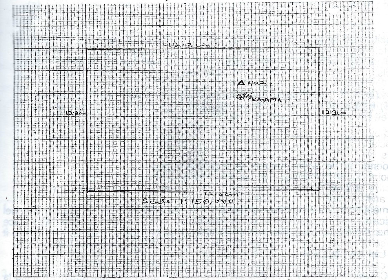
(1) Nodal town (Kaiama)
(2) No secondary road shown on the topographical map
Trigonometrical station
Solution
Length on map 27.4cm (+ 0.2cm) =
Scale of map = 1:50,000
Therefore length on ground =
27.4cm x 50 000 km
100,000
= 27.4km
2
= 13.7km + 0.2km:
(13.5 — 13.9km)
(d)Solution
i. Land use types
a. Agriculture or farming because of scattered cultivation
(b) Transportation because of roads and paths
(c) Settlements because of towns and villages
(d) Animal grazing because of Savanna
Social Amenities
1. Postal Agency — mail
2. Market — Trading
3. Rest House — Hospitality / Tourism
4. Church — Religion
5. School — Education
6. Health Centre —Health care
Post an Explanation Or Report an Error
Your email address will not be published. Required fields are marked *